Chagadai Khanate map
By Altanbagana Baatar
DBA Candidate| Independent Historian
ImperialGG Historical Research Seriers
26 June 2026
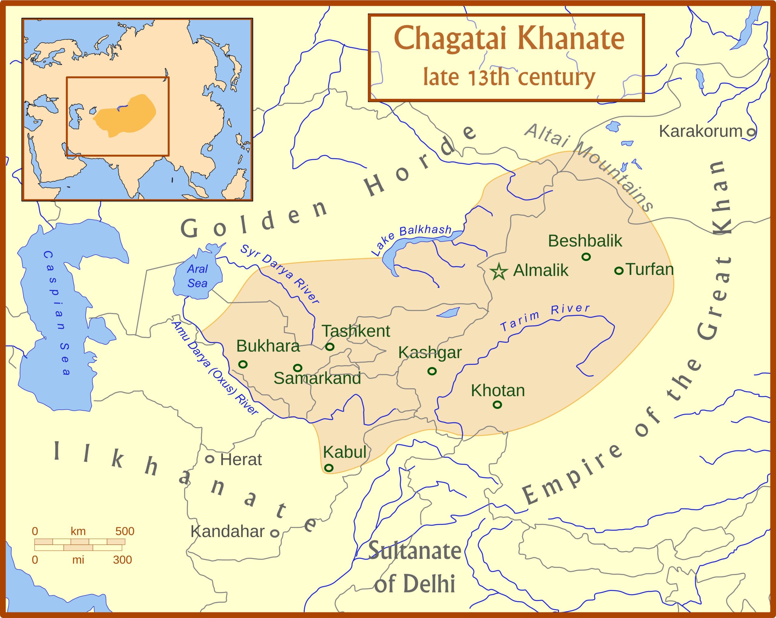
Figure 1. The Chagatai Khanate in the Late Thirteenth Century
This map illustrates the approximate territorial extent of the Chagatai Khanate during the late thirteenth century. Occupying the geographical heart of Eurasia, the khanate encompassed territories corresponding roughly to present-day Kyrgyzstan, much of Uzbekistan, southeastern Kazakhstan, eastern Turkmenistan, northern Afghanistan, and China’s Xinjiang Uyghur Autonomous Region, together with adjacent areas of Central Asia.
Major urban centers, including Almaliq, Kashgar, Bukhara, Samarkand, Tashkent, and Kabul, lay within its sphere of influence. The khanate controlled critical segments of the Silk Roads connecting China, the Islamic world, India, and the Eurasian steppes, making it one of the principal crossroads of medieval Eurasia.
Far from being a peripheral successor state of the Mongol Empire, the Chagatai Khanate became a major center of political, economic, and cultural interaction. Within its territories emerged the political traditions, literary culture, and social transformations that would profoundly shape the later history of Central Asia and contribute to the formation of a distinct Chagataid world.
Source: Adapted from Peter Jackson, The Mongols and the Islamic World (2017); Michal Biran, The Qara Khitai Empire in Eurasian History (2005); and David Morgan, The Mongols (2007).
Note: The boundaries shown are approximate and should not be interpreted as corresponding precisely to modern international borders.